Automative Geomapping Technologies
A lot has been written about mapping technologies lately.
Among the news regarding some well known companies, like the acquisition of the Nokia Here mapping division by Audi, BMW and Daimler, or the collaboration agreement between TomTom and Bosch, there was also a recent article about a new centimeter-accurate low-cost GNSS (Global Navigation Satellite System) receiver developed by The University of Texas.
Accurate GNSS receivers have been available for a long time, but before they were too big in physical size and too expensive for the mass market. Combining accuracy with low cost could dramatically change the mapping industry as we know it today.
Two Costly Problems
There are two distinct problems that the automotive mapping companies have to address on a daily basis. The first one is constant roadmap refreshing: big money is being spent on constant road mapping so that the maps faithfully reflect the real world situation. The second one is real-time traffic information acquirement: huge amounts of traffic data has to be acquired from local traffic management companies to push real-time traffic data to the navigation systems that rely on their own maps ecosystem.
A Cheap but Imperfect Solution
There exists a potential solution to the second issue (centralized and costly data acquisition) which is performed by the majority of the mapping companies — it's called the collective or crowd-funded approach.
A company called Waze, now owned by Google, relies on this approach for real-time traffic information collection. The idea is great: getting an accurate picture of the traffic situation, for free – not just for the user, but for the company too. The navigation app that is running on millions of mobile devices sends the user’s speed and location data to a server that can predict driving times for the drivers. Additionally, users can report different events such as potholes, accidents, traffic jams, and gas prices using the navigation app.
However, there are drawbacks to this crowd-funded information collection approach:
- Users have to input all the events manually
- Up to date maps still have to be provided a priori
Manual road event reporting has some straightforward but quite serious shortcomings. First of all, the driver has to use the smartphone while driving – actively navigate through the menus to report an event, which can cause you to get a ticket, not to mention the serious danger of not paying attention to the road. Moreover, even if a driver decides to use the app anyway, there is a great probability that he or she will not report everything. After all, it is up to the driver to decide what to report and what to leave out.
The Solution Could Be Coming Soon
Despite its many advantages, the collective approach does not solve the mapping task. There are some volunteer-based initiatives such as OpenStreetMap, but they require a group of users who are committed to editing the maps. Moreover, the volunteer-based nature of these services introduces some additional potential issues, including update delays and different mapping errors.
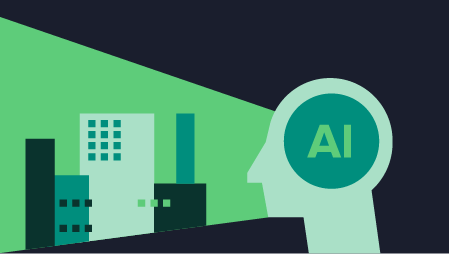
All aspects of the traffic situation and map correctness can become fully automated with the advent of deep learning, low-cost accurate navigation systems, affordable stereo vision, and state-of-the-art sensor fusion. All of the technologies mentioned above, except for the low-cost accurate navigation systems, are already present in the flagship models of the most advanced automakers, or at least assisting with the development of their autonomous concept cars. Eventually, when the technology spreads down to the whole range of models, a car manufacturer with a fleet consisting of hundreds of thousands of its own cars driving out on the open roads could become a novel map and traffic info service provider.
Assuming that a high precision low-cost GNSS positioning receiver will be commercially available soon, we can safely say that we have the foundation for an automated collective mapping and traffic reporting platform at hand. The missing link – the road situation awareness, which was done by humans until a couple of years back, has been efficiently replicated using deep neural networks. Combined with the vast amount of data coming from a variety of sensors available in modern high-end cars — accurate stereo vision, radars, odometry, lidar, light sensors, rain sensors, traction control sensors, etc. — and an accurate GNSS receiver, a state-of-the-art data fusion algorithm could pinpoint most of the features found in its field of view with sufficient positional accuracy and correctly tag them to update the 3D map it is using on the maps server. All of the data (on road dimensions, traffic signs, intersections, accidents, construction sites, traffic jams, parking lot occupancy, weather info, etc.) would automatically be fed to a server that would continuously update its database. Everything would operate without any distraction to the driver or any need for his or her input.
The Possibilities – A Look Ahead to the Roads of the Future
The possibilities are endless and exciting. I will mention just a few that I can think of off the top of my head.
Drivers could receive warning of a slippery road or strong lateral wind on the road, which would be detected by a ESP stability system integrated in a car driving a couple of kilometers ahead.
The same goes for hail warning — the car could use what it sees in its cameras, the temperature changes, and the sound in the cockpit to predict severe weather and appropriately warn other drivers through its navigation system, maybe even offering a detour. The knowledge acquired by a car and the entire mapping ecosystem would be shared among all of the other vehicles connected to the network.
What about a car that constantly scans its surroundings while driving? It could read the gas prices by the gas stations and update them on the server for others to see. The same principle would be applicable for parking lot occupancy determination in city centers or parking lots. There would be no need for stationary systems integrated into the roads.
A changed road sign or a new roundabout built over an old intersection could be scanned, detected, measured, classified in real time and sent to the mapping server, while the data coming from the whole fleet of cars could be used to enhance the precision of the measurements or to cover the gaps in the freshly updated map.
Data from cars equipped with systems like the Road Surface Scan from Mercedes-Benz could be used to determine the most deteriorated roads, which would be useful for local administrative entities.
All of these applications would be immediately useful today, with drivers behind the wheel. Just imagine the immense possibilities in a few years when autonomous cars hit the road.